

Cycling in the Cotswolds and Gloucestershire
The Cotswolds are rightly known as one of the most glorious parts of the British Isles, and there are many excellent cycling routes in the area.
This is an Area of Outstanding Natural Beauty, and a bike ride taking in villages such as Stow-on-the-Wold, Broadway and Bourton-on-the-Water will confirm that.
Then there are the surrounding gorgeous towns (or in some cases small cities), including Cheltenham, Gloucester, Stroud, Cirencester and – just outside the area – Oxford.
Much of the Cotswolds are in the county of Gloucestershire, but not all, so this blog post extends into west Oxfordshire and southern Warwickshire. For the very southern part of the Cotswolds Area of Outstanding Natural Beauty, see the separate post on Somerset and Bristol.
Gloucestershire also includes country to the west of the River Severn, including the Forest of Dean, so that is included here as well.
Below you will find sections on different aspects of cycling in the Cotswolds and Gloucestershire:
- Suggested cycle touring and cycling holiday hubs
- Gentle / family bike rides
- Circular cycle tours
- Guide books and maps for cycle touring
- Waymarked long-distance cycle routes
- Mountain biking / off-road cycle routes
- Cycle-friendly holiday accommodation
- Cycling maps and guide books
There are excellent maps and guide books for the Cotswolds, with maps from Ordnance Survey (the OS Tour series) and Goldeneye Maps, plus various cycle guide books, of which more below.
All the maps are listed at the bottom of the page, or you can click on a link to go direct to them in the Bike Ride Maps shop.
So whether you are local to the area, or planning a cycling holiday in the Cotswolds, I hope the following helps.
Suggested cycle touring and cycling holiday hubs in Gloucestershire and the wider Cotswolds
The Cotswolds and Gloucestershire have a wealth of places to stay and possible starting points for cycle touring. These are just some possible places to consider:
- Bourton-on-the-Water is quite central in the Cotswolds and so makes a good base, and is of course a beautiful little village
- Chipping Norton in the eastern part of the Cotswolds and not far from Oxford, has some very good cycle routes based here
- Stroud is a working town, with a great mix of shops and cafés, and is not too far from Gloucester and Cheltenham as well as the honeypot villages of the Cotswolds
The official Cotswolds.com website has more suggestions for places to stay.

Gentle / family bike rides in the Cotswolds

The Cotswolds are a range of hills and so are generally not flat territory for younger families. Having said that, there are some flatter, gentler family bike rides in and around the area.
Cotswold Country Park circular route
An 8-mile ride on generally quiet lanes starting in the Cotswold Country Park near Cirencester.
A diversion will take you into Cirencester, the ‘capital of the Cotswolds’.
Map: The Goldeneye Cotswold Country Lanes map
The Stroud Valley Cycle Trail
A 5-mile traffic-free trail on a converted railway line between Stonehouse and Nailsworth, with a traffic-free link into Stroud.
The route is great for families, with lots to see along the way.
Map: The Goldeneye Cotswold Country Lanes map
The Gloucester & Sharpness Canal

A 13-mile more-or-less flat ride from Slimbridge Wetland Centre to the city of Gloucester at the dockside.
Much of it is canalside or close to the River Severn and is described well on the website “South West towpath bike rides: Gloucester & Sharpness Canal.”
Why not take time to visit the remarkable Slimbridge Wetland Centre and its wonderful birdlife as well as the city of Gloucester?

Map: The Goldeneye Cotswold Country Lanes map
The Forest of Dean Family Trail
A circular 9-mile route on converted mining tracks in the Forest of Dean between Coleford and Cinderford.
The surface is fine and the route is almost entirely traffic-free. So this is very suitable for all the family. A range of bikes can be hired at the start from Pedalabikeway (Cannop Valley, Nr Coleford, Forest of Dean, GL16 7EH.
Map: The Goldeneye Cotswold Country Lanes map has an overview, while a detailed map can be picked up at Pedalabikeaway when you arrive.
Circular cycle tours in and around the Cotswolds

There are many lovely cycle touring routes around the Cotswolds and Gloucestershire. Below are some special ones, with details of each route in the guide book or map shown:
Bourton-on-the-Water Loop via The Slaughters (from Cicerone’s Cycling in the Cotswolds)
This is a 14-mile ‘relatively gentle’ route involving both road and bridleway cycling, with the author not recommending a road bike for the off-road sections. She suggests on-road detours instead.
It’s a glorious route, starting in the centre of the quintessential Cotswold village of Bourton-on-the-Water and taking in the picturesque Upper and Lower Slaughter.
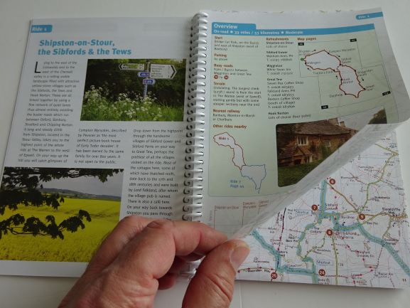
Guide book: ‘Cycling in the Cotswolds’ by Chiz Dakin, published by Cicerone
Chipping Norton Circular Route via Moreton-in-Marsh (from Goldeneye’s Cotswold Country Lanes map)
The Goldeneye Cotswolds map shows three really good cycle tours out of Chipping Norton. This one is 29 miles and takes you on fairly quiet lanes to Moreton-in-Marsh. There are certainly hills along the way, but beautiful little villages and glorious countryside.
Map: The Goldeneye Cotswold Country Lanes map
The High Cotswolds from Moreton-in-Marsh to Chipping Camden & Stow-on-the-Wold
A 30-mile ride from Moreton-in-Marsh including Stow-on-the-Wolds, Batsford, Chipping Camden and Broadway Tower. A hilly routed with several climbs. Takes in some of the best of the Cotswolds.
Guide book: ‘Cycle Tours Around Oxford‘
‘Around the Cotswolds’ (from Cicerone’s Cycling in the Cotswolds)
A 130-mile ‘moderate/challenging’ multi-day loop around the Cotswolds.
Starting in Stroud, the route takes in Chipping Camden, Stow-on-the-Wold, Burford and Cirencester, with possible detours to the likes of Broadway.
It’s a brilliant way to see much of the Cotswolds. Be prepared for hills!
Guide book: ‘Cycling in the Cotswolds’ by Chiz Dakin, published by Cicerone
Creating your own tour
To plan your own tour, you can get an overview of the whole of the Cotswolds and Gloucestershire from the OS Tour map.
However, bear in mind that it doesn’t show contours and is also very big when opened out, and so is not ideal for when you are actually cycling.
The Goldeneye Country Lanes map of the area gives a better idea of height levels and the Sustrans pocket-sized maps have contours shown. Goldeneye maps are particularly robust for carrying with you on a tour.
Waymarked long-distance cycle routes in and around the Cotswolds

There are several waymarked National Cycle Network routes that cross the area. They do not have their own specific maps, but can be found on more general maps.
NCN Route 41
National Cycle Network Route 41 starts in Bristol and should eventually finish in Rugby in Warwickshire.
For now, the signposted route is from Bristol and follows the River Severn up to Slimbridge Wetland Centre. From there it leads into Gloucester and then Cheltenham.
Maps: Sustrans pocket-sized maps – The Goldeneye Cotswold Country Lanes map
NCN Route 45
NCN Route 45 is signposted all the way from Salisbury to Chester. It enters our area south of Cirencester and heads west to Stroud. It joins Route 41 for a while as it leads into Gloucester, and then takes on its own numbering again heading north to Tewkesbury.
Maps: Sustrans pocket-sized maps – The Goldeneye Cotswold Country Lanes map
NCN Route 48
Route 48 runs northwards from Cirencester to Northleach. When last checked, there was then a gap before the signposted route reappears at Stow-on-the-Wold, heading on to Moreton-in-Marsh and Shipston-on-Stour.
Maps: Sustrans pocket-sized maps – The Goldeneye Cotswold Country Lanes map
National Byway – Midlands
The National Byway is a series of long-distance cycle routes linking places of historic interest, whether they are stately homes, castles, ancient villages or prehistoric sites.

There is a National Byway route crossing the southern part of the Cotswolds, which has its own map plus signposting on the ground. Be aware that the signposting has not been maintained in recent years, so a map is needed in case signs are missing.
The Cotswolds section is the end part of the National Byway – Midlands. It starts in Chester and heads down through the Welsh Marches before crossing into Gloucestershire south of Ledbury. It then runs east to Tewkesbury and loops around Cheltenham to finish in Cirencester.
Map: The National Byway – Midlands
Mountain biking / off-road cycle routes in the Cotswolds
Off-road routes in the Cotswolds tend to be rolling hills, but generally not flat, with one or two exceptions.
There are two excellent sources of mountain bike or off-roade cycle routes: the ‘Goldeneye Off-road Cycle Map‘ and the ‘Cotswolds Mountain Biking‘ guide book from Vertebrate.
The Goldeneye map has 10 routes from around the area, ranging from Easy to Moderate to More Strenuous. Examples include:
- Cotswold Water Park, 10 or 13 mostly flat miles. Grade 1
- The Broadway Circuit, 15 1/2 miles, of which 7 is off-road. Grade 2
- Charlebury Circuit, 18 1/2 miles, of which 14 1/2 is off-road. Grade 2

The Cotswolds Mountain Biking guide book has 20 route guides from right across the region. They range from Easy right through to Killers and include, for example:
- Cold Aston ride, 13Km. “While never difficult, there are loose tracks, rutted fields and a couple of steep sections”.
- Birdlip ride, 29Km. “Good trails through lovely scenery”.
- Nailsworth and Wotton-Under-Edge, 59Km. A “big ride” with “1,600m of climbing and tricky descents”.

Cycle-friendly Holiday Accommodation in the Cotswolds and Gloucestershire

This section is still to be completed.
The maps and guide books for cycling in the Cotswolds and Gloucestershire
To order a map or guide book, you can click on a link to go to the shop. Or pop one straight in your basket by clicking “Add to basket”.
The Goldeneye maps are both double-sided and made of tough weatherproof paper:


The Cicerone ‘Cycling in the Cotswolds’ guide book has 20 good long rides. The Cycle Tours Around Oxford guide book has 20 rides altogether, of which 7 are in the Cotswolds, the remainder in the Chilterns, near the Ridgeway etc.

The Ordnance Survey Tour map has the whole area on one side of one (very large) map. The National Byway map of the Midlands has a route across the southern part of the Cotswolds.


The Cotswolds Mountain Biking guide book has 20 off-road MB routes in the Cotswolds:

I hope this has been useful. Other parts of the country are covered in the Cycling In… series here.
