Description
Edinburgh Cycle Map
by Spokes, the Lothian Cycle Campaign
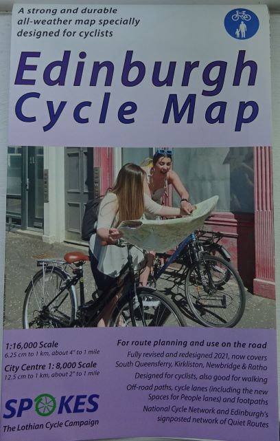 The Edinburgh Cycle Map from Spokes, updated in 2021, is a highly detailed map showing off-road paths and cycle lanes in and around Scotland’s capital city.
It marks quiet roads, links, crossings, as well as steep hills, cobbles and hazards.
National Cycle Network routes are shown, including NCN Route 1, the Coast and Castles South route, plus NCN Routes 75 and 76.
The main map is 4.1″ to the mile, while on the reverse are maps of
- The City Centre
- Around Edinburgh
- Edinburgh to Glasgow and Around the Forth
- The Borders.


The map is printed on tear-proof and water-resistant recyclable polyethylene.
Edinburgh Cycle Map
- Published by Spokes, the Lothian Cycle Campaign
- Updated 2021