Posted on

Ride in the Steps of the Packhorses – Trails Perfect for Electric Off-road Cycling

Ancient direction post on the Roman Road at Hope Brink

The South Pennines and Peak District Off-Road Cycle Map

by Richard Peace, cycling journalist, guide book author, map designer: https://richardpeacecycling.com/

Packhorse Trails were the motorways of their day

I spent last summer riding many of the finest tracks in the South Pennines and the northern Peak District in order to produce this tough, waterproof map.

For many years, before the days of tarmac, these tracks were the motorways of their day, with incredibly hardy packhorse ponies bringing the necessities of life like salt from as far afield as Cheshire and also acting as the HGVs of the very early cotton and woollen industries in the area, still dotted with early weavers’ hamlets and villages.

Today they are the bedrock (literally in some cases) of some great off-road riding. Add in the canals of the area and you have one of the most varied, visually striking and beautiful areas in the whole of the UK for off-road riding.

Best Track Highlights from the South Pennines and Peak District Off-Road Cycle Map

Along Reddyshore Scout

Here’s my top five scenic tracks and lanes of the area (in no particular order), all detailed on the map as part of longer bike routes:

  1. Colden Clough Road – Just west of tourist magnet Heptonstall, next to Hebden Bridge, this gradually climbing broad track takes you through a wonderful ancient wooded valley then onto moorland scenery to end at a pub.
  2. Reddyshore Scout Gate – A broad, easy to ride track climbs high above the steep sided Upper Roch valley with great views down onto colourful canal boats and small rows of terraces decorating the Rochdale Canal.
  3. Pennine Bridleway – Hayfield to Rushup Edge. A great section of this well-signed National Trail. Rocky in places but plenty of broad tracks too with stunning views over to the highest point in the Peak District National Park, Kinder Scout.
  4. Hope Brink – Actually thought to be much older than packhorse trails, being marked as a Roman road on maps. Fantastic views down Edale from the old direction post at Hope Cross.
  5. Wessenden Valley – Improved by the National Trust who own large tracts of Wessenden Moor, this is now one of the best quality off-road tracks in the South Pennines and makes a wonderful descent from the moors into the attractive old mill town of Marsden.

Family ride highlights

Easy trails around the Longdendale Valley

Family ride highlights on the map include the Longdendale Trail and the Calder & Hebble Canal but there are many more.

The latter has been undergoing a scheme of surface improvements to make it even better for cycling thanks to the excellent CityConnect project.

Daunting No More

I surveyed the whole of the area using electric bikes which I also write reviews of. They mean terrain once unconquerable to someone in his mid-50s with a dodgy back and knees is now a joy to ride through. And I still get a good workout in the process.

Here’s selection of my favourite e-bikes I reviewed whilst riding the routes.

E-biking on the Pennine Bridleway heading towards Kinder Scout
  1. Riese & Muller Delite Mountain Rohloff – A no-holds barred, no expense spared full suspension e-mtb that also comes with rack and lights and a double battery, making it the best off-road e-bike I’ve tried for long distance, ride-all-day off-road e-biking.
  2. Brose Drive S Mag E-bikes – Any e-mtb with a new Brose Drive S Mag motor should give great power yet still be relatively lightweight. Here’s a comprehensive e-mtb test where it is declared winner. 
  3. Carrera Vengeance-E – Halfords own brand and great for family and easier emtb trails
  4. Riese & Muller Nevo GX – Great for older riders or anyone who struggles to get their leg over a higher top tube design. One of the very few off-road step thru e-bikes with incredibly sporty and bullet-proof performance as you would expect from this company.

Map Details

There are three main elements to the waterproof map:

South Pennines and Peak District Off-road Cycle Map
  1. A 110 mile ‘Pike to Peak’ circular ‘challenge’ route, linking the famous landmarks of Stoodley Pike near Hebden Bridge to Rushup Edge and Mam Tor in the Peak District National Park. The Pike to Peak is around 75% off-road and uses old packhorse trails and turnpike roads to take in some of the area’s most stunning scenery and attractive towns and villages. The Pike to Peak can be tackled in the form of two smaller loops to make it more manageable as it is bisected by the TPT, meaning you also have the option of two smaller loops of 78 miles and 43 miles.
  2. 14 shorter circular day rides along classic trails such as Hope Brink, Wessenden Valley, Holme Valley, Reddyshore Scout, Ladybower Reservoir and the Hope Valley. These range from 8 miles to 26 miles.
  3. 20 family trails including the Calder Valley Greenway, Longdendale Trail, Upper Don Trail, Tame Valley Trail, Huddersfield Narrow Canal, Sett Valley Trail and many more.

In compiling the map I tried to pick out the best examples of off-road riding in the area by picking out broad, rideable tracks for adventurous leisure riders (though of course being in the heart of the Pennines there are still plenty of gradients unless you choose one of the family trails on the map). The route choice is ideal for electric mountain bikers getting their first taste of the activity.

The map also features:

  • Cycle-friendly accommodation listings with a link to internet pages featuring lots more detail.
  • GPX route files – internet links that guide users to web pages where they can download GPX route files for all the rides and get more background information about the routes.

South Pennines & Peak District Off-road Cycle Map

  • ISBN: 978-1901464382
  • Folded size: 24.4 x 13.8 x 1.2 cm
  • Unfolded size: 68cm x 48cm
Posted on

Cycling in the Peak District and Derbyshire

Cycling in Derbyshire and the Peak District

Cycling in the Peak District and Derbyshire

Derbyshire and the Peak District have a wonderful range of cycle routes, from level (or very gently sloping) converted railway lines to wild mountain bike routes. And everything in between.

Below you will find sections on different aspects of cycling in Derbyshire and the Peak District:

  • Suggested cycle touring and cycling holiday hubs
  • Gentle / family bike rides
  • Cycle touring
  • Waymarked long-distance cycle routes
  • Mountain biking / off-road cycle routes
  • Cycle-friendly holiday accommodation
  • Cycling maps and guide books

There is an excellent range of maps and guide books to help you plan routes and to help you find your way.

Suggested cycle touring and cycling holiday hubs in the Peak District and Derbyshire

The Peak District has all sorts of accommodation available in many parts of the National Park. The following are just three of the towns with good links to great cycling:

  • Bakewell, on the Monsal Trail and access to various road and off-road routes
  • Ashbourne, close to the Tissington Trail and other routes
  • Buxton, with country lanes leading to both of the above trails and excellent longer routes

Gentle / family bike rides in the Peak District and Derbyshire

Sustrans, the Peak District National Park authority and the local authorities have done a wonderful job in creating family-friendly cycle trails from some of the most scenic disused railway lines in the Peak District.

The Monsal Trail

The Monsal Trail
The Monsal Trail

Starting in lovely Bakewell itself, a quiet lane leads to the Monsal Trail, 8.5 miles of traffic-free cycleway. It’s very popular with cyclists of all types, especially families. There are tunnels to cycle through!

There is even a brilliant shop / cafe / bike hire shop part way along, complete with small play area at Hassop Station.

Guide book: Family Cycle Rides in the Peak District

The Tissington Trail

Starting in Ashbourne, the Tissington Trail is a 13-mile cycle trail through Dovedale. It’s not flat, but the gradients were designed for trains, so not major.

Take time to visit Herbert’s Team Rooms at Tissington Hall along the way.

The trail also joins the High Peak cycle trail, yet another former railway line, so you can extend your ride nearly all the way to Cromford, south of Matlock.

Guide book: Family Cycle Rides in the Peak District

Ladybower Reservoir

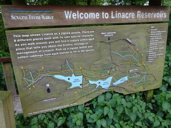
Linacre Reservoir cycle trail

The Peak District has a good number of reservoirs serving the cities and towns around the rim of the National Park. Several of them have good cycling by them.

The Ladybower Reservoir is one of the largest of the reservoirs and has a there-and-back route along one side. 7.5 miles long and undulating on first a lane and then a track, the views over the water are magnificent. Perfect for a quiet picnic part way along with the family.

Guide book: Cycling in the Peak District – Off-road Trails and Quiet Lanes

Linacre Reservoirs

Linacre Reservoir

You won’t find this short route in any guide book I have found. It’s a bit of a secret. Ssshhhh!

Just outside Chesterfield are three linked reservoirs. The bottom two have a cycle trail around them through gorgeous woods, probably only 2-3 miles long depending which way you go.

Find the car park at Woodnook Lane, Cutthorpe, S42 7AU. There is no café, but there are toilets and often an ice cream van!

Circular cycle tours in the Peak District and Derbyshire

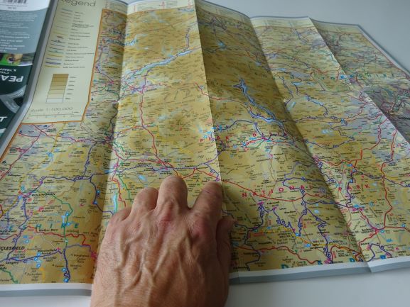
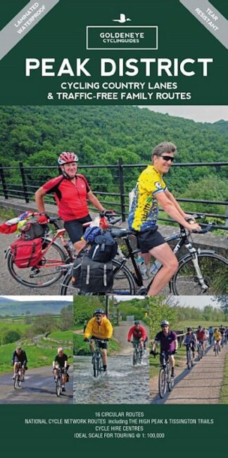
You can choose your own routes around the National Park using the Ordnance Survey Tour Map for the Peak District or the Goldeneye Peak District map – Cycling Country Lanes & Traffic-free Family Routes, or of course you can pick routes from the very good cycle guide books to the area.

The Buxton and Bakewell Loop

This is a 30-mile ride from Cicerone’s Cycling in the Peak District book, starting either in Buxton or at Hassop Station near Bakewell.

Mostly on quiet roads, it also includes the Monsal Trail. Highly recommended.

Guide book: Cicerone’s Cycling in the Peak District (including 21 routes on lanes and tracks)

The Chelmorton Loop

This is a 12-mile loop, partly on the High Peak Trail and then on quiet roads through the villages of Chelmorton and Monyash. There are some significant hills here. A good challenge.

(And if you want to go further, start at Ashbourne on the Tissington Trail first, before joining the High Peak Trail.)

Guide book: Cycling in the Peak District – Off-road Trails and Quiet Lanes ( including 18 routes, plus notes on family routes)

Hope, Hathersage and Edale Loop

This is a much longer loop, 44 miles, starting and finishing in Hathersage. It’s clearly marked on the excellent Goldeneye Peak District map.

Significant hills, beautiful villages, the lovely Edale Valley.

Map: Goldeneye Peak District map – Cycling Country Lanes & Traffic-free Family Routes (including 11 suggested routes, but this is a map of the whole area, so you can also design your own routes).

Bakewell and Hartington Loop

A 26-mile cycle route, again from Cicerone’s very good guide book, this is mostly on road and has some juicy hills through lovely countryside.

The ride starts in Bakewell and heads south and west, with part of the route shown for mountain-bikes only and an alternative road-bike route shown.

Bakewell
Bakewell

Guide book: Cicerone’s Cycling in the Peak District

Waymarked long-distance cycle routes in the Peak District and Derbyshire

The Pennine Cycleway South, National Cycle Network Route 68

The Pennine Cycleway starts in Derby and takes quiet lanes as far as Ashbourne. From there it joins the Tissington Trail before a road finish in Buxton. The route then heads to Glossop before crossing into Yorkshire to bypass Huddersfield, leaving our Peak District area.

Map: Pennine Cycleway South

The Pennine Bridleway

The Pennine Bridleway is designed for mountain bikers and horse riders. It starts at Middleton Top in the south of the region, heading north west. It bypasses Buxton in the hills and heads further north west into Lancashire.

Map: Pennine Bridleway guide book

Mountain biking / off-road cycle routes in the Peak District and Derbyshire

The Peak District has of course some great mountain bike routes.

Goldeneye’s ‘Mountain Bike Routes’ map has rides from 10 to 17 miles long, beautifully mapped. Routes include the hills around Bakewell, Eyam, Buxton, Stanage and Edale.

There is also the ‘South Pennines and Peak District Off-Road Cycle Map’ from Excellent Books, designed with long-distance epic routes, day rides and 20 family-friendly off-road rides. It covers the north of the region – Hathersage northwards.

Vertebrate publish two books of off-road and mountain bike routes. Their ‘Cycling in the Peak District – Off-road Trails and Quiet Lanes’ and their ‘White Peak Mountain Biking’. The two books have very different kinds of routes, pretty much doing what they say on the tin.

For tough mountain bike routes, go for the White Peak or for Goldeneye’s map. Or both, of course.

Links to all of the above are below.

Cycle-friendly Holiday Accommodation

Ashbourne on market day

This section is still to be completed.

The maps and guide books for cycling in the Peak District and Derbyshire

There is an excellent range of maps and guide books to select from.

Here is a quick preview of some of them:

They are available in the webshop, and you can link to them or put them in your basket below:

For walking routes, try the Hikes in Peak District post on the 10 Adventures website.